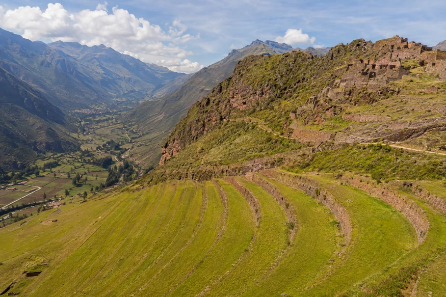
The Pisac ruins form one of the largest and most visually impressive Inca archaeological complexes in Peru's Sacred Valley. Terraces wrap around a high mountain ridge above Pisac town, while ceremonial buildings, residential areas, towers and an extensive hillside cemetery reveal that this was far more than an agricultural site.
This guide explains how to visit Pisac ruins from Cusco, which ticket is required, how much time to allow and whether to combine the archaeological park with Pisac Market.
Pisac archaeological park is a network of Inca sectors built along a mountain ridge guarding the eastern entrance to the Sacred Valley. The Incas adapted the slopes with agricultural terraces and connected ceremonial, residential and defensive areas through paths and stairways.
The site is often associated with Emperor Pachacutec's expansion, although its exact functions and chronology remain subjects of archaeological interpretation. Its scale is best understood by visiting more than the first viewpoint.
The ruins sit above modern Pisac town, approximately 33 kilometers northeast of Cusco. The upper vehicle entrance and the lower town access are not the same place.
Most visitors drive to the upper entrance and explore the principal sectors from there. A longer trail descends toward Pisac town, but its availability and condition should be confirmed before starting.
Private transport normally takes around one hour, depending on traffic and stops. The road climbs to the upper entrance, avoiding a demanding ascent from town.
Public and shared transport generally reaches Pisac town rather than delivering visitors directly to the upper archaeological entrance. From town, an additional taxi or a substantial uphill walk may be necessary. A City Tour and Pisac experience coordinates the transport and archaeological visit.
Pisac is normally included in the Cusco Tourist Ticket's Sacred Valley circuit and in the Integral Ticket. It is not included with a Machu Picchu admission ticket, and admission to the ruins is separate from purchases at Pisac Market.
Because tariffs and sales rules can change, verify the current ticket options directly with COSITUC. Carry your identification and protect the physical ticket throughout the circuit.
Confirm current opening hours before departure. An early visit usually brings cooler temperatures, clearer views and fewer tour groups. Morning light also reveals the geometry of the terraces particularly well.
Weather changes quickly on the ridge. In the rainy season, clouds and showers can reduce visibility and make stone paths slippery. Start with the most important sectors rather than leaving them until closing time.
Allow two to three hours for a useful visit from the upper entrance. One hour is enough only for the first viewpoints and a limited portion of the complex.
A longer downhill exploration toward Pisac town can require three to four hours or more, depending on the open route, fitness and stops. Confirm the exit plan with staff or a guide before committing to the descent.
The immense curved terraces follow the mountain's contours and helped create stable agricultural surfaces. They also demonstrate sophisticated control of drainage and erosion.
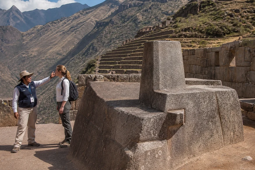
Finely fitted stonework distinguishes the sacred sector, traditionally associated with solar observation and ritual activity. Access routes can be controlled to protect the site.
Groups of buildings occupy different parts of the ridge, reflecting planned divisions of activity. Towers and commanding sightlines emphasize Pisac's strategic position.
Thousands of burial cavities are visible across the opposite cliff. Many were looted, and visitors must observe the protected area from authorized paths.
A descending route has traditionally connected the upper archaeological park with the town. It provides changing views and access to more sectors than a short return visit.
However, trail access can be modified because of maintenance, weather or conservation work. Ask staff about the current route before beginning, carry water and avoid starting late. The descent contains steep steps and exposed sections.
Yes. The ruins and market are separate attractions but combine naturally in a half-day or full-day plan. Visit the ruins first for cooler weather, then continue to the town and market.
The market is busiest on traditional market days, while artisan stalls operate more frequently. Travelers primarily interested in archaeology should not reduce the ruins to a quick photo stop just to maximize shopping time.
| Feature | Pisac Ruins | Ollantaytambo Ruins |
|---|---|---|
| Landscape | Wide ridge and sweeping curved terraces | Steep monumental terraces above town |
| Typical time | 2–3 hours | 1.5–2.5 hours |
| Route style | Multiple sectors spread along paths | Concentrated climb to ceremonial structures |
| Easy pairing | Pisac town and market | Machu Picchu train connection |
If time permits, visit both because their architecture and landscapes are different. For more detail, see our complete Ollantaytambo ruins guide.
A short visit from the upper entrance is moderately demanding, with uneven paths and stone stairs. The complete descent is more strenuous and requires reliable footwear and comfort with prolonged downhill walking.
The upper site approaches Cusco's elevation. Recently arrived travelers should move slowly, stay hydrated and avoid turning the first day at altitude into an endurance test.
To organize the wider region, use our Sacred Valley luxury travel guide. Travelers wanting all principal sites in one coordinated day can review the Sacred Valley, Maras and Moray tour.
Yes. The scale of the terraces, ridge-top sectors and Sacred Valley views makes Pisac one of the region's essential archaeological sites.
Yes, with the correct ticket. A guide substantially improves the visit because the complex is extensive and interpretation on site may be limited.
The upper sectors are close to Cusco's elevation, while Pisac town is lower. Altitude can still affect recently arrived visitors.
No. The market is in Pisac town below the archaeological park. Transport or a long descending trail connects the two areas.